Getting there
- Flights to Målselv (BDU) 80 km from the start
- Flights to Kiruna (KRN) 85 km from the start
Treks / Sweden
Sweden · Nearest city: Stockholm (also Kiruna)
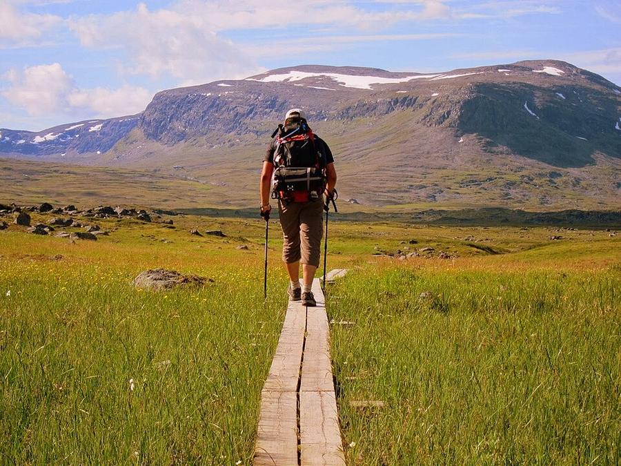
The northern section of Sweden's King's Trail, through Arctic valleys and past Kebnekaise, Sweden's highest mountain.
Watch out: Mosquitoes in July, and huts can be far apart. Carry cash or a card for the hut shops.
It's Sweden's great wilderness walk in Lapland, with the midnight sun, reindeer and Sweden's highest mountain.
The northern Kungsleden from Abisko to Nikkaluokta, staying at the Swedish Tourist Association's mountain huts. You leave the Kungsleden at Singi to finish at Nikkaluokta.
An easy start through birch forest beside the Abiskojåkka river canyon.
Sleep: Abiskojaure mountain hut
Above the treeline into open fells, past a Sami summer settlement. A boat can shorten the day.
Sleep: Alesjaure mountain hut
A wide, wild valley with reindeer grazing.
Sleep: Tjäktja mountain hut
The high point of the trail and the long view down Tjäktjavagge.
Sleep: Sälka mountain hut
A gentle valley walk between big mountains.
Sleep: Singi mountain hut
You leave the Kungsleden and head east under Sweden's highest mountain.
Sleep: Kebnekaise Fjällstation
Downhill through birch forest. A boat across Ladtjojaure saves about 6 km.
Sleep: Bus to Kiruna
Day 4, crossing the Tjäktja pass at about 1,150 m, the highest point of the trail, with the long Tjäktjavagge valley stretching south below you.
Kebnekaise Fjällstation, after day 6, is the place to stop: a full day to climb Kebnekaise, Sweden's highest mountain, or simply to rest.
Some of these are affiliate links: if you book through them we may earn a small commission, at no extra cost to you. We only list services that fit this trek.
Phone plans from the EU and EEA roam here at home prices. Coming from the US, UK or elsewhere? A Europe data eSIM is usually far cheaper than roaming.
Expect long stretches with no signal on the trail. Download offline maps and our GPX before you start.
Most travel insurance includes hiking at this height. Check that hiking is listed and that medical evacuation is covered.
Rescue is not the same as evacuation. Travel insurance usually pays to fly you to hospital, but not always for the search and rescue itself. Read the policy's "search and rescue" section.
True Traveller sells only to UK and EEA residents. Always check the altitude limit and your country of residence in the policy wording. Our trekking insurance guide explains what to look for.
Under Sweden's Right of Public Access you can camp for a night or two almost anywhere, away from huts and homes. Campers can pay a small fee to use hut facilities.
Rules change and differ between parks. Check with the local park or tourist office before you pitch a tent.
Map layers load on the live site. Use the overview below meanwhile.
Straight lines between stops One colour per day (dashed: straight line, not the exact path) Start / finish Stop on the way Nearest city
Switch between Topo, Satellite and Street layers with the layer button, and turn on the marked hiking trails overlay. We don't have the exact trail for this route yet, so stops are joined with straight lines. Always carry a proper hiking map on the trail.
Stops: Abisko → Kebnekaise → Nikkaluokta
Best time: Late June to September
Late June to mid-July
Midnight sun or very long days, snow patches on high ground and fast-flowing snowmelt rivers. Mosquitoes peak.
Bring
Late July to August
Warmest and most stable weather, fewer mosquitoes later in August, but busiest huts.
Bring
September
Stunning autumn colours and the first northern lights, but cold nights, first snow on the tops and some huts closing.
Bring
Mosquitoes can be intense in early summer. Bring a head net, repellent and long sleeves.
You'll ford rivers without bridges. Cross early in the day when levels are lower, unclip your hip belt, and use poles. Bring sandals or light shoes for crossing.
8 photos taken on and around the route by Wikimedia Commons photographers. Tap one to see it bigger.
Photo credits: Kungsleden trail by Shyguy24x7, CC BY-SA 3.0, via Wikimedia Commons; Lapporten by Lapplaender, CC BY-SA 2.0 de, via Wikimedia Commons; Abisko overview by Ojan, CC0, via Wikimedia Commons; Crevasse at Storglaciären by Leonhard Lenz, CC0, via Wikimedia Commons; Storglaciären with Kebnekaise behind by Leonhard Lenz, CC0, via Wikimedia Commons; Dag Hammarskjöldsleden in Ladtjovagge by Leonhard Lenz, CC0, via Wikimedia Commons; Dag Hammarskjöldsleden in Ladtjovagge by Leonhard Lenz, CC0, via Wikimedia Commons; Valley between Tarfala and Ladtjovagge by Leonhard Lenz, CC0, via Wikimedia Commons. Photos resized for the web. Figures are approximate and vary with the variant you choose.


