Getting there
- Flights to Dresden (DRS) 25 km from the start
Treks / Germany
Germany · Nearest city: Dresden (also Berlin, Prague)
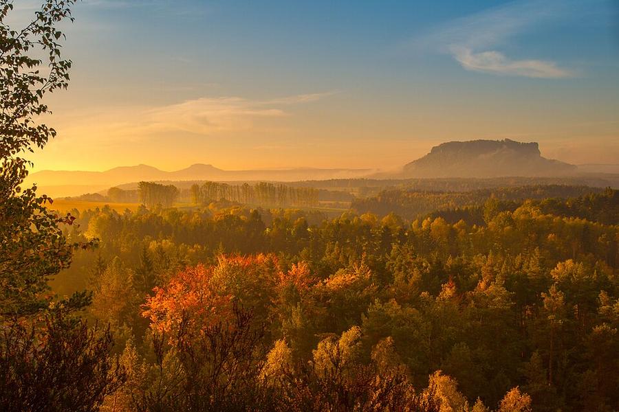
An eight-stage loop through the sandstone towers of Saxon Switzerland, the landscape that inspired the Romantic painters.
Watch out: Lots of steep steps and ladders. Popular spots like the Bastei get busy at weekends.
It's one of Germany's most beautiful long walks, through sandstone towers and gorges that inspired Caspar David Friedrich, and it's easy to reach by train from Dresden.
Some of these are affiliate links: if you book through them we may earn a small commission, at no extra cost to you. We only list services that fit this trek.
Phone plans from the EU and EEA roam here at home prices. Coming from the US, UK or elsewhere? A Europe data eSIM is usually far cheaper than roaming.
Expect long stretches with no signal on the trail. Download offline maps and our GPX before you start.
Most travel insurance includes hiking at this height. Check that hiking is listed and that medical evacuation is covered.
Rescue is not the same as evacuation. Travel insurance usually pays to fly you to hospital, but not always for the search and rescue itself. Read the policy's "search and rescue" section, or join an Alpine club: membership of the Austrian Alpenverein (it has an English-speaking UK section) includes rescue cover of up to €25,000.
True Traveller sells only to UK and EEA residents. Always check the altitude limit and your country of residence in the policy wording. Our trekking insurance guide explains what to look for.
Wild camping is generally not allowed in Germany. Use campsites, huts or official trekking pitches where they exist.
Rules change and differ between parks. Check with the local park or tourist office before you pitch a tent.
Map layers load on the live site. Use the overview below meanwhile.
Trail from OpenStreetMap (116.4 km) Start / finish Stop on the way Nearest city
Switch between Topo, Satellite and Street layers with the layer button, and turn on the marked hiking trails overlay. The trail line is the OpenStreetMap hiking route and may differ from the variant you choose. Always carry a proper hiking map on the trail.
Stops: Pirna → Stadt Wehlen → Bastei → Hohnstein → Großer Winterberg → back to Pirna
Best time: April to October
April to May
Fresh green forests and cool, comfortable temperatures. Paths can be muddy.
Bring
June to August
Warm and sometimes hot, with thunderstorms and busy weekends at popular viewpoints.
Bring
September to October
Beautiful autumn colours and quieter trails, with cooler mornings.
Bring
Iron ladders and steep steps are part of the route. Keep poles strapped to your pack on these sections.
9 photos taken on and around the route by Wikimedia Commons photographers. Tap one to see it bigger.
Photo credits: Lilienstein Saxon Switzerland by Merops, CC BY-SA 3.0, via Wikimedia Commons; Human rights memorial Castle-Fortress Sonnenstein by Kalispera Dell, CC BY 3.0, via Wikimedia Commons; Wehlen by Norbert Kaiser, CC BY-SA 3.0, via Wikimedia Commons; Burgruine Wehlen by Bybbisch94, Christian Gebhardt, CC BY-SA 4.0, via Wikimedia Commons; View near Bastei by Bybbisch94, Christian Gebhardt, CC BY-SA 4.0, via Wikimedia Commons; Reinhardtsdorf.Krippenberg by Bybbisch94, CC BY 4.0, via Wikimedia Commons; Naturschutzgebiet Pfaffenstein in by Chmee2, CC BY-SA 4.0, via Wikimedia Commons; Xl -Wanderung zum Felsentor Kuhstall (Sächsische Schweiz) in Zeiten des Klimawandels by Molgreen, CC BY-SA 4.0, via Wikimedia Commons; Nationalpark Sächsische Schweiz Großer Winterberg lub img Bergsteig by Lukas Beck, CC BY-SA 4.0, via Wikimedia Commons. Photos resized for the web. Figures are approximate and vary with the variant you choose.


_2006-06-10.jpg)


.JPG)
_in_Zeiten_des_Klimawandels_(2024)_7.jpg)
