Getting there
- Flights to Madrid (MAD) 50 km from the start
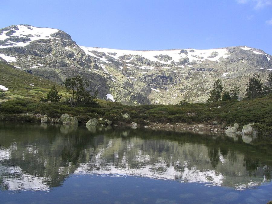
The highest peak of the Sierra de Guadarrama, an easy escape from Madrid with glacial lakes and wide views.
Watch out: Snow lingers into spring and winter conditions need proper gear.
Planning it for later? Save to Pinterest
It's Madrid's closest real mountain, with glacial lakes and wide views over the Castilian plain.
Some of these are affiliate links: if you book through them we may earn a small commission, at no extra cost to you. We only list services that fit this trek.
Phone plans from the EU and EEA roam here at home prices. Coming from the US, UK or elsewhere? A Europe data eSIM is usually far cheaper than roaming.
Expect long stretches with no signal on the trail. Download offline maps and our GPX before you start.
This trek reaches 2,428 m. The policies below include hiking on marked routes to at least 3,000 m without an upgrade: World Nomads for UK residents and True Traveller to 3,000 m, SafetyWing's Nomad Insurance to 4,500 m, and World Nomads for US residents to 6,000 m. Limits differ by country of residence, so check yours.
Rescue is not the same as evacuation. Travel insurance usually pays to fly you to hospital, but not always for the search and rescue itself. Read the policy's "search and rescue" section.
True Traveller sells only to residents of the UK and Europe. Always check the altitude limit and your country of residence in the policy wording. Our trekking insurance guide explains what to look for.
Wild camping is regulated by each region and generally banned in natural parks. Mountain refuges and campsites are the norm.
Rules change and differ between parks. Check with the local park or tourist office before you pitch a tent.
Measured by us along the OpenStreetMap trail with open elevation data (about 30 m resolution). Expect real figures a few percent higher: maps smooth out small zigzags and bumps, and the highest summits read slightly low.
Map layers load on the live site. Use the overview below meanwhile.
Trail from OpenStreetMap (5.0 km) Start / finish Stop on the way Nearest city
Switch between Topo, Satellite and Street layers with the layer button, and turn on the marked hiking trails overlay. The trail line is the OpenStreetMap hiking route and may differ from the variant you choose. Always carry a proper hiking map on the trail.
Stops: Puerto de Cotos → Peñalara
Best time: May to November
April to May
Fresh green forests and cool, comfortable temperatures. Paths can be muddy.
Bring
June to August
Warm and sometimes hot, with thunderstorms and busy weekends at popular viewpoints.
Bring
September to October
Beautiful autumn colours and quieter trails, with cooler mornings.
Bring
Early in the season, snow can cover the path on high ground. Microspikes or crampons and some experience make these sections safer.
5 photos taken on and around the route by Wikimedia Commons photographers. Tap one to see it bigger.
Last updated 29 October 2026. Spotted something out of date? Tell us.
Photo credits: Circo y cima de Peñalara by Miguel303xm, CC BY-SA 2.5, via Wikimedia Commons; Cotos by No machine-readable author provided. Miguel303xm~commonswiki assumed (based on copyright claims)., CC BY 2.5, via Wikimedia Commons; Peñalara (Madrid) - panoramio by Carlos Ramón Bonilla…, CC BY-SA 3.0, via Wikimedia Commons; Peñalara (Madrid) - panoramio by Carlos Ramón Bonilla…, CC BY-SA 3.0, via Wikimedia Commons; Camino viejo del Paular - panoramio by Axel Schlaefer, CC BY-SA 3.0, via Wikimedia Commons. Photos resized for the web. Figures are approximate and vary with the variant you choose.


