Getting there
- Flights to Stavanger (SVG) 35 km from the start
Treks / Norway
Norway · Nearest city: Stavanger
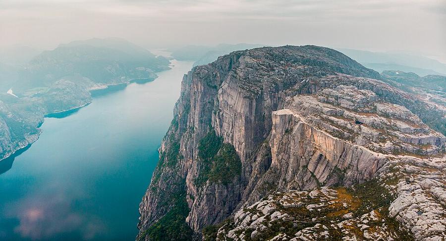
A short, popular hike to a flat-topped cliff 604 m above the Lysefjord.
Watch out: Very busy in summer. Go early in the morning or late in the afternoon.
It's a flat-topped cliff 604 m above the Lysefjord, reached on a short hike most people can do.
Some of these are affiliate links: if you book through them we may earn a small commission, at no extra cost to you. We only list services that fit this trek.
Phone plans from the EU and EEA roam here at home prices. Coming from the US, UK or elsewhere? A Europe data eSIM is usually far cheaper than roaming.
Expect long stretches with no signal on the trail. Download offline maps and our GPX before you start.
Most travel insurance includes hiking at this height. Check that hiking is listed and that medical evacuation is covered.
Rescue is not the same as evacuation. Travel insurance usually pays to fly you to hospital, but not always for the search and rescue itself. Read the policy's "search and rescue" section.
True Traveller sells only to UK and EEA residents. Always check the altitude limit and your country of residence in the policy wording. Our trekking insurance guide explains what to look for.
Norway's allemannsretten lets you camp for up to two nights in uncultivated land, at least 150 m from houses and cabins.
Rules change and differ between parks. Check with the local park or tourist office before you pitch a tent.
Map layers load on the live site. Use the overview below meanwhile.
Trail from OpenStreetMap (5.9 km) Start / finish Stop on the way Nearest city
Switch between Topo, Satellite and Street layers with the layer button, and turn on the marked hiking trails overlay. The trail line is the OpenStreetMap hiking route and may differ from the variant you choose. Always carry a proper hiking map on the trail.
Stops: Preikestolen
Best time: April to October
Late June to mid-July
Midnight sun or very long days, snow patches on high ground and fast-flowing snowmelt rivers. Mosquitoes peak.
Bring
Late July to August
Warmest and most stable weather, fewer mosquitoes later in August, but busiest huts.
Bring
September
Stunning autumn colours and the first northern lights, but cold nights, first snow on the tops and some huts closing.
Bring
6 photos taken on and around the route by Wikimedia Commons photographers. Tap one to see it bigger.
Photo credits: Lyse Fjord et Preikestolen by Clementp.fr, CC BY-SA 4.0, via Wikimedia Commons; LysebotnViewFromAbovePreikestolen by Andreas Tille, CC BY-SA 4.0, via Wikimedia Commons; Noorwegen by rob Stoeltje from loenen, netherlands, CC BY 2.0, via Wikimedia Commons; View near Preikestolen by Maarten Heerlien from Voorschoten, The Netherlands, CC BY 2.0, via Wikimedia Commons; Noorwegen by rob Stoeltje from loenen, netherlands, CC BY 2.0, via Wikimedia Commons; View near Preikestolen by Maarten Heerlien from Voorschoten, The Netherlands, CC BY 2.0, via Wikimedia Commons. Photos resized for the web. Figures are approximate and vary with the variant you choose.


.jpg)
.jpg)
.jpg)
.jpg)