Getting there
- Flights to Bishkek (BSZ) 55 km from the start
Kyrgyzstan · Nearest city: Bishkek
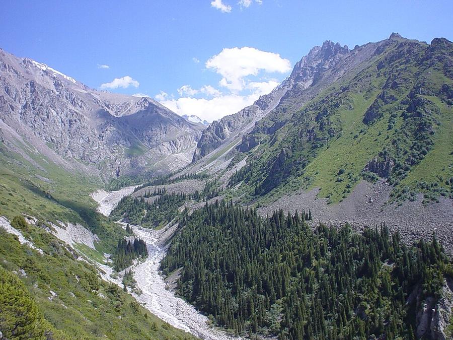
A steep climb from a national park just outside Bishkek to a mountaineers' hut below the Ak-Sai glacier and the peaks of the Kyrgyz Range.
Watch out: The climb is steep and relentless. Glacier travel beyond the hut needs a guide.
Planning it for later? Save to Pinterest
It's big mountain scenery half an hour from Bishkek, perfect for acclimatising.
Ala Archa is the national park you can see from Bishkek: forty minutes after leaving the city you are at a trailhead under 4,000 m peaks. The walk to the Ratsek Hut is the park's classic day: a steep, steady climb from pine forest to a stone hut at about 3,300 m, sitting on a moraine below the Ak-Sai glacier.
It's short on the map and big on the legs. The trail gains over 1,200 m in six kilometres, which is steeper than most days on the Tour du Mont Blanc.
We haven't walked this route ourselves. This guide combines our own measurement of the trail with reports from people who walked it between 2024 and 2026. Sources are at the end.
Yes, if you're fit, used to steep hill days and want a real mountain day within reach of the capital. It's also the best acclimatisation walk before Ala-Kul.
Think twice if you've just flown in. Bishkek is at 800 m, and going to 3,300 m and back in a day leaves many people with a headache. Take a day or two in the city first, or turn round at the waterfall viewpoint about halfway.
| Our measurement | What other guides say | |
|---|---|---|
| Trailhead (Alplager) | 2,130 m | about 2,150–2,200 m |
| Ratsek Hut | about 3,300 m | 3,240–3,350 m |
| Distance, one way | 6.1 km | 6.8–7 km |
| Climb | 1,240 m | 1,200–1,500 m |
Plan on 4 to 6 hours up and 2.5 to 3.5 down, so 7 to 9 hours for the day. Our line was drawn by a routing tool along the paths mapped in OpenStreetMap, which is why it comes out a little shorter than a GPS track with all its zigzags.
The first hour climbs through juniper and pine above the river. The middle section crosses open slopes with a view of the Ak-Sai waterfall. The last hour is the hard one: steep, loose stones up the moraine to the hut.
Start before 8 am. The lower slopes get hot by midday, and afternoon cloud often hides the peaks.
Prices reported for 2025 and 2026:
| What | Reported price |
|---|---|
| Park entry | about 200 som per adult |
| Taxi from Bishkek to the trailhead | 600–1,000 som each way |
| Bed at the Ratsek Hut | $15 per person ($25 for the private room) |
| Camping by the hut | $3 per person per day |
| Meals at the hut | $10–20 each |
The hut is basic: bunk rooms, no shower, a dining room. Bring a sleeping bag. Beds and meals are offered when the hut is staffed in the main season, so confirm before you rely on it.
A taxi ordered through a ride app is the simple way: about 40 minutes from the centre of Bishkek. Ask to be taken to the Alplager at the top of the road, not just to the park gate.
The cheap way is marshrutka 265 (about 30 som), but it stops at the main gate, which is 12 km below the trailhead. You then have to walk the road or hitch.
Getting back is the harder part: there is little phone signal at the trailhead, and few taxis wait there. Agree a pick-up time with your driver, or be ready to ask for a lift down to the gate.
Distance and climb come from our own measurement: a line routed along OpenStreetMap paths and sampled against open elevation data (about 30 m resolution). Prices, transport and conditions come from these guides, checked in October 2026:
Walked it recently and found something different? Tell us and we'll update this page.
Some of these are affiliate links: if you book through them we may earn a small commission, at no extra cost to you. We only list services that fit this trek.
Roaming in Kyrgyzstan is expensive on most phone plans. A data eSIM bought before you fly gets you online as soon as you land.
Expect long stretches with no signal on the trail. Download offline maps and our GPX before you start.
This trek reaches 3,300 m, above the 3,000 m that World Nomads (for UK residents) and True Traveller include as standard: you need World Nomads' Level 2 upgrade (to 4,500 m) or True Traveller's Adventure pack (to 4,600 m). SafetyWing's Nomad Insurance covers hiking on official paths up to 4,500 m, and World Nomads' US Standard plan up to 6,000 m.
Rescue is not the same as evacuation. Travel insurance usually pays to fly you to hospital, but not always for the search and rescue itself. Read the policy's "search and rescue" section.
True Traveller sells only to residents of the UK and Europe. Always check the altitude limit and your country of residence in the policy wording. Our trekking insurance guide explains what to look for.
Wild camping is common and accepted in Kyrgyzstan's mountains. Yurt camps and guesthouses are good alternatives.
Rules change and differ between parks. Check with the local park or tourist office before you pitch a tent.
Measured by us along the OpenStreetMap trail with open elevation data (about 30 m resolution). Expect real figures a few percent higher: maps smooth out small zigzags and bumps, and the highest summits read slightly low.
Map layers load on the live site. Use the overview below meanwhile.
Trail routed along OpenStreetMap paths (6.3 km) Start / finish Stop on the way Nearest city
Switch between Topo, Satellite and Street layers with the layer button, and turn on the marked hiking trails overlay. The trail line is the OpenStreetMap hiking route and may differ from the variant you choose. Always carry a proper hiking map on the trail.
Stops: Ala Archa National Park
Best time: June to September
June to early July
Snow still on high passes, fast rivers from snowmelt and green pastures filling with herders.
Bring
Mid-July to August
The best weather window, but high passes can still get snow and storms.
Bring
September
Clear skies and autumn colours, with freezing nights and herders leaving the high pastures.
Bring
Some days climb 1,000 m or more. Train with stairs and a loaded pack, and use trekking poles.
You'll feel the altitude on the climbs. Spend a night or two in the mountains first if you can, and pace yourself.
4 photos taken on and around the route by Wikimedia Commons photographers. Tap one to see it bigger.
Last updated 29 October 2026. Spotted something out of date? Tell us.
Photo credits: Ala archa by The original uploader was Garthwillis at English Wikipedia., CC BY 2.5, via Wikimedia Commons; Ochotona rutila by Dmitry Kulakov, CC BY 4.0, via Wikimedia Commons; Capra sibirica by Griha Hasanov, CC BY 4.0, via Wikimedia Commons; River Ala-Archa, Kyrgyzstan - panoramio by ThomasG, CC BY-SA 3.0, via Wikimedia Commons. Photos resized for the web. Figures are approximate and vary with the variant you choose.


