Getting there
- Flights to Podgorica (TGD) 90 km from the start
Montenegro · Nearest city: Podgorica (also Dubrovnik, Žabljak)
The highest peak of Durmitor National Park: up from the Sedlo road pass, a short cabled scramble to the top, and down to the Black Lake at Žabljak.
Watch out: The last half hour is a narrow ledge with steel cables. Go only in dry, settled weather.
Planning it for later? Save to Pinterest
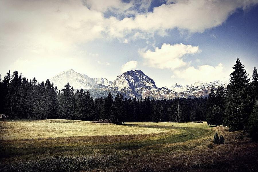
It's the highest peak in Durmitor National Park, one of the Balkans' wildest limestone landscapes.
Bobotov Kuk (2,523 m) is the highest peak of Durmitor, the limestone massif above the town of Žabljak in northern Montenegro. It's a walk, not a climb, until the last half hour: then the path narrows to a ledge with steel cables, and you use your hands.
There are two normal ways up, and they meet at a pass just below the top. One starts high, at the Sedlo road pass, and is short. The other starts at the Black Lake on the edge of Žabljak and is long. The best day joins them: up from Sedlo, down to the lake.
We haven't walked this route ourselves. This guide combines our own measurement of the trail with reports from people who walked it between 2024 and 2026. Sources are at the end.
Yes, if you're used to full mountain days, steady on rough limestone, and comfortable with a short exposed scramble where a slip would be serious.
Think twice if heights bother you. Reports mention walkers turning back at the cables. You can still have a fine day by stopping at the Velika Previja pass (2,351 m), half an hour below the summit. For a high Balkan summit with no scrambling, look at Musala.
The line on our map is the traverse: Sedlo pass to the summit, then down to the Black Lake and the park entrance at Žabljak.
| Section | Distance | Climb | Descent |
|---|---|---|---|
| Sedlo pass (1,907 m) → summit | 4.5 km | about 710 m | about 105 m |
| Summit → Black Lake → park entrance | 8.2 km | about 10 m | about 1,100 m |
| Whole traverse | 12.7 km | about 720 m | about 1,200 m |
Open elevation data smooths a sharp peak, and our line reads the summit about 105 m too low. We've added that back to the climbs and descents above, which is why they say "about".
What other guides give: 9.5 to 12 km and 730 to 940 m of climbing for Sedlo and back, in 5.5 to 6.5 hours; about 14.4 km and 6 hours of walking for the traverse; about 20 km and 8.5 to 11 hours for the Black Lake and back.
From Sedlo the path crosses meadows, then a first cabled step at Uvita Greda, a boulder-filled valley and the small lake of Zeleni Vir (2,028 m). A steep pull leads to the Velika Previja pass, where the Black Lake path comes in. The last half hour is a narrow, airy ledge and a short cabled section to the summit.
Go only when it is dry and the forecast is stable: polished limestone and steel cable are both treacherous when wet. Start before 8.30 am. Storms build in the afternoon, and the narrow sections get congested later in the morning in high summer.
Prices reported for 2025 and 2026:
| What | Reported price |
|---|---|
| Durmitor National Park day ticket | €5 per person (under 15 free) |
| Annual card for all Montenegrin national parks | €13.50 |
| Taxi Žabljak → Sedlo | €15–20 one way |
| Parking at Sedlo | free, small |
A ranger sells tickets at the Sedlo trailhead (cash is safest) and at the Black Lake entrance. The annual card is reported as sold only at the Black Lake entrance. If you'll spend three days or more in Montenegro's parks, it pays for itself.
Žabljak is the base: a small mountain town with guesthouses, hostels, shops and taxis.
Žabljak is about 124 km from Podgorica: 2.5 to 3 hours by bus or car. The airports most people use are listed in the Before you go box on this page.
Sedlo is on the scenic P14 road, 14 km and about 25 minutes from Žabljak. Book the taxi the evening before. If you're doing the traverse you don't need one back; if you're returning to Sedlo, agree a pick-up time before the driver leaves.
Distances and climbs come from our own measurement: a line routed along OpenStreetMap paths and sampled against open elevation data (about 30 m resolution), corrected at the summit as explained above. Prices, timings and conditions come from these guides, checked in October 2026:
Walked it recently and found something different? Tell us and we'll update this page.
Some of these are affiliate links: if you book through them we may earn a small commission, at no extra cost to you. We only list services that fit this trek.
EU 'roam like at home' doesn't apply in Montenegro, and many plans charge extra there. A Europe data eSIM covers Montenegro too.
Expect long stretches with no signal on the trail. Download offline maps and our GPX before you start.
This trek reaches 2,523 m. The policies below include hiking on marked routes to at least 3,000 m without an upgrade: World Nomads for UK residents and True Traveller to 3,000 m, SafetyWing's Nomad Insurance to 4,500 m, and World Nomads for US residents to 6,000 m. Limits differ by country of residence, so check yours.
Rescue is not the same as evacuation. Travel insurance usually pays to fly you to hospital, but not always for the search and rescue itself. Read the policy's "search and rescue" section.
True Traveller sells only to residents of the UK and Europe. Always check the altitude limit and your country of residence in the policy wording. Our trekking insurance guide explains what to look for.
Camping is allowed only in designated places inside Durmitor National Park.
Rules change and differ between parks. Check with the local park or tourist office before you pitch a tent.
Measured by us along the OpenStreetMap trail with open elevation data (about 30 m resolution). Expect real figures a few percent higher: maps smooth out small zigzags and bumps, and the highest summits read slightly low.
Map layers load on the live site. Use the overview below meanwhile.
Trail routed along OpenStreetMap paths (13.2 km) Start / finish Stop on the way Nearest city
Switch between Topo, Satellite and Street layers with the layer button, and turn on the marked hiking trails overlay. The trail line is the OpenStreetMap hiking route and may differ from the variant you choose. Always carry a proper hiking map on the trail.
Stops: Sedlo pass → Bobotov Kuk → Black Lake
Best time: July to September
June to early July
Snow patches linger on north-facing slopes and high passes. Huts are just opening, meadows are full of flowers and paths are quieter.
Bring
Mid-July to August
Most reliable weather, but also the busiest huts and frequent afternoon thunderstorms. Hot in the valleys.
Bring
September
Clear, stable days and fewer people, but shorter daylight, cold nights and some huts closing mid to late September.
Bring
A few short hands-on sections. Keep your hands free and your pack tidy.
Paths can be faint or disappear in mist. Carry an offline map on your phone and a paper map, and know how to use them.
6 photos taken on and around the route by Wikimedia Commons photographers. Tap one to see it bigger.
Last updated 29 October 2026. Spotted something out of date? Tell us.
Photo credits: Durmitor by Andrea Polereczky, CC BY-SA 3.0, via Wikimedia Commons; The Black Lake in Montenegro by Jshnay, CC BY-SA 4.0, via Wikimedia Commons; Bobotov Kuk by Goran.Smith2, CC BY-SA 3.0, via Wikimedia Commons; Durmitor National Park in Montenegro by Miomir Magdevski, CC BY-SA 4.0, via Wikimedia Commons; Crno jezero by Alexkom000, CC BY 4.0, via Wikimedia Commons; Ka Škrčkom Ždrijelu - panoramio by Emil Joanović, CC BY-SA 3.0, via Wikimedia Commons. Photos resized for the web. Figures are approximate and vary with the variant you choose.


