Getting there
- Flights to Annecy (NCY) 60 km from the start
- Flights to Geneva (GVA) 70 km from the start
Treks / France · Switzerland
France · Switzerland · Nearest city: Geneva (also Chamonix, Zermatt)
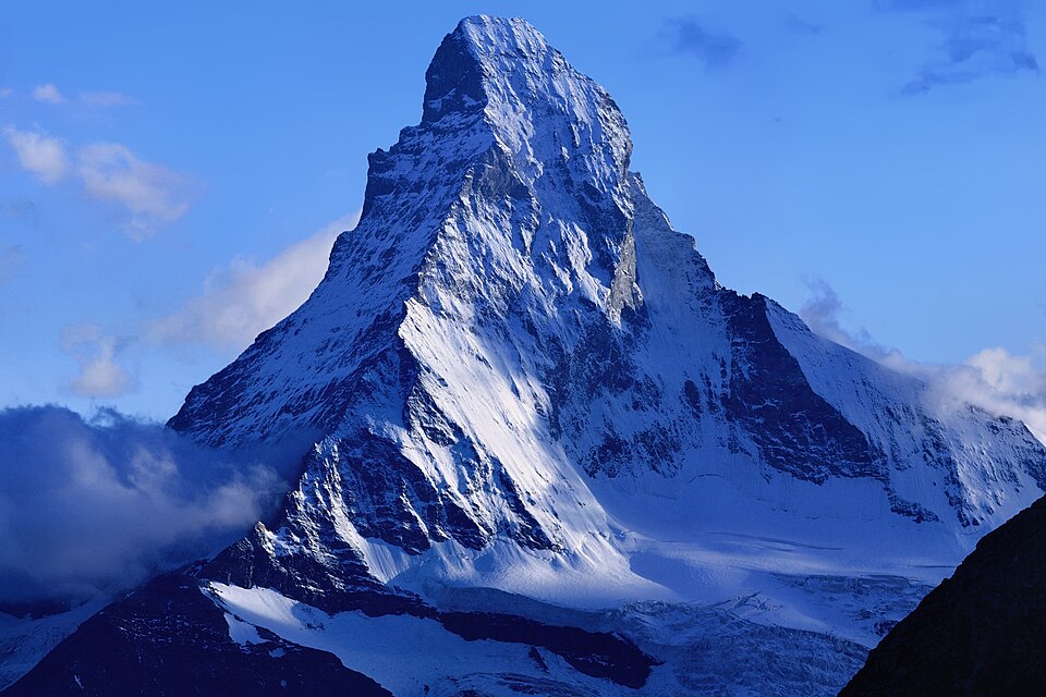
The classic walking route from Chamonix to Zermatt, from Mont Blanc to the Matterhorn. It crosses eleven passes and ends with some of the finest views in the Alps.
Watch out: Long, steep days with big climbs back to back. Some passes hold snow into July.
It links the two most iconic mountains of the Alps, Mont Blanc and the Matterhorn, and many consider it more spectacular and more demanding than the TMB.
Some of these are affiliate links: if you book through them we may earn a small commission, at no extra cost to you. We only list services that fit this trek.
EU 'roam like at home' doesn't apply in Switzerland, and many plans charge extra there. A Europe data eSIM covers Switzerland too.
Expect long stretches with no signal on the trail. Download offline maps and our GPX before you start.
This trek reaches 2,965 m, and many policies stop covering hiking at 2,000 to 3,000 m unless you add an activity upgrade. World Nomads needs its Level 3 activities above 2,000 m, Heymondo its Adventure add-on above 3,000 m, and SafetyWing's Nomad Insurance covers trekking up to 4,500 m.
Rescue is not the same as evacuation. Travel insurance usually pays to fly you to hospital, but not always for the search and rescue itself. Read the policy's "search and rescue" section, or join an Alpine club: membership of the Austrian Alpenverein (it has an English-speaking UK section) includes rescue cover of up to €25,000.
True Traveller sells only to UK and EEA residents. Always check the altitude limit and your country of residence in the policy wording. Our trekking insurance guide explains what to look for.
Rules vary. In many mountain areas a bivouac from dusk to dawn is tolerated, but national parks have strict zones. Check the park's rules before you pitch.
Rules change and differ between parks. Check with the local park or tourist office before you pitch a tent.
Map layers load on the live site. Use the overview below meanwhile.
Trail from OpenStreetMap (209.3 km) Route variant Start / finish Stop on the way Nearest city
Switch between Topo, Satellite and Street layers with the layer button, and turn on the marked hiking trails overlay. The trail line is the OpenStreetMap hiking route and may differ from the variant you choose. Always carry a proper hiking map on the trail.
Stops: Chamonix → Champex → Verbier → Arolla → Zinal → Gruben → St. Niklaus → Zermatt
Best time: July to mid-September
June to early July
Snow patches linger on north-facing slopes and high passes. Huts are just opening, meadows are full of flowers and paths are quieter.
Bring
Mid-July to August
Most reliable weather, but also the busiest huts and frequent afternoon thunderstorms. Hot in the valleys.
Bring
September
Clear, stable days and fewer people, but shorter daylight, cold nights and some huts closing mid to late September.
Bring
Early in the season, snow can cover the path on high ground. Microspikes or crampons and some experience make these sections safer.
Long downhills are harder on your knees than the climbs. Poles, well-laced boots and slow steps make a big difference.
Thunderstorms often build after midday in summer. Start early, cross passes and summits before noon, and never shelter under lone trees or on ridges.
Some days climb 1,000 m or more. Train with stairs and a loaded pack, and use trekking poles.
7 photos taken on and around the route by Wikimedia Commons photographers. Tap one to see it bigger.
Photo credits: Matterhorn from Domhütte by Photo: chil, on Camptocamp.org Derivative work:Zacharie Grossen, CC BY-SA 3.0, via Wikimedia Commons; Arolla by the author named on its Commons page, CC BY-SA 3.0, via Wikimedia Commons; Chamonix valley from la Flégère by Ximonic, Simo Räsänen, CC BY-SA 3.0, via Wikimedia Commons; Alpes by Guillaume Baviere from Uppsala, Sweden, CC BY-SA 2.0, via Wikimedia Commons; Zinal depuis Le Belvédère - panorama by Christian David, CC BY-SA 4.0, via Wikimedia Commons; Refuge du Rothorn by Christian David, CC BY-SA 4.0, via Wikimedia Commons; Charles Kuonen Hängebrücke Panorama by Daniel Reust, CC BY-SA 4.0, via Wikimedia Commons. Photos resized for the web. Figures are approximate and vary with the variant you choose.


.jpg)


