Getting there
- Flights to Podgorica (TGD) 45 km from the start
Albania · Kosovo · Montenegro · Nearest city: Tirana (also Shkodër, Podgorica, Pristina)
A cross-border loop through the Accursed Mountains of Albania, Kosovo and Montenegro, staying in village guesthouses.
Watch out: Border crossings require a permit registered in advance.
Planning it for later? Save to Pinterest
It's a cross-border trek through three countries, staying with shepherd families in the Accursed Mountains.
The Peaks of the Balkans is a ten-stage loop through the Accursed Mountains, where Albania, Kosovo and Montenegro meet. You walk from village to village across limestone passes and high pastures, and you sleep in family guesthouses where dinner is whatever was grown or milked that day. It opened as a marked trail in 2012, and it still feels like the Alps did decades ago: fewer signs, fewer people, far lower prices.
It's the closest thing in Europe to the Tour du Mont Blanc for hikers who find the Tour du Mont Blanc too crowded or too expensive. The walking is just as hard. The logistics are harder: three countries, border permits and cash only.
We haven't walked this route ourselves. This guide combines our own measurement of the trail with the official route information and reports from people who walked it between 2024 and 2026. Sources are at the end.
Yes, if you've done a hut-to-hut trek before, you're comfortable with 6 to 8 hour days and around 1,000 m of climbing day after day, and you can follow a GPS track when the paint marks run out.
Think twice if this is your first multi-day trek, or if you want everything bookable online in an afternoon. The Tour du Mont Blanc and the Alta Via 1 are easier to organise.
We measured the main loop as mapped in OpenStreetMap, walked anticlockwise from Theth.
| Stage | From → to | Distance | Climb | Descent | Highest point |
|---|---|---|---|---|---|
| 1 | Theth → Valbonë | 15 km | 940 m | 840 m | 1,780 m |
| 2 | Valbonë → Çerem | 15 km | 590 m | 380 m | 1,250 m |
| 3 | Çerem → Dobërdol | 18 km | 1,360 m | 340 m | 2,220 m |
| 4 | Dobërdol → Milishevc | 14 km | 420 m | 820 m | 2,240 m |
| 5 | Milishevc → Rekë e Allagës | 15 km | 790 m | 1,210 m | 2,120 m |
| 6 | Rekë e Allagës → Kuqishtë | 19 km | 860 m | 1,040 m | 1,800 m |
| 7 | Kuqishtë → Babino Polje | 18 km | 1,300 m | 860 m | 2,240 m |
| 8 | Babino Polje → Plav | 20 km | 530 m | 1,100 m | 2,040 m |
| 9 | Plav → Vusanje | 21 km | 1,120 m | 1,040 m | 2,080 m |
| 10 | Vusanje → Theth | 19 km | 770 m | 960 m | 1,710 m |
Our line adds up to about 174 km and 8,700 m of climbing. The official figure is 192 km: map lines smooth out zigzags, and some stages start and finish at guesthouses a little off the mapped line. Expect your own days to be 10 to 15 per cent longer than this table.
The hardest days are stages 3 and 7, each with about 1,300 m of climbing. The best-known is stage 1, over the Valbona pass.
You cross three borders on mountain passes with no checkpoint, so you need a cross-border permit from each country before you go.
Walkers often report meeting no guards at all. Others have been turned back without papers. Get the permits.
Prices reported for 2025 and 2026:
| What | Reported price |
|---|---|
| Guesthouse, shared room, with dinner and breakfast | €30–40 per person |
| Guesthouse, private room or better standard | €45–55 per person |
| Packed lunch | usually a few euros extra, or included in full board |
| Permits through an agency | about €20–25 per person |
Almost everything is paid in cash, in euros. Plav is the only real town on the loop, with cash machines and shops, so carry enough for the stages before and after it.
Stage distances and climbs come from our own measurement: the OpenStreetMap route sampled against open elevation data (about 30 m resolution), with climbs counted in 10 m steps. Permits, prices and season come from these sources, checked in October 2026:
Walked it recently and found something different? Tell us and we'll update this page.
The classic ten-stage loop, walked anticlockwise from Theth. Most people take ten walking days plus one or two spare days; several stages can be shortened with a 4x4 transfer.
Over the Valbona pass on the best-known day walk in Albania.
Sleep: Guesthouse in Valbona
Up through beech forest to a quiet summer village close to the Montenegrin border.
Sleep: Guesthouse in Çerem
A long day through forest and meadow to a bowl of high pasture where three countries meet.
Sleep: Shepherds' guesthouse in Dobërdol
Across the border ridge into Kosovo, the highest and most open stage of the loop.
Sleep: Guesthouse in Milishevc
Over a pass and down into the Rugova valley.
Sleep: Guesthouse in Rekë e Allagës
A shorter day along the side of the Rugova gorge.
Sleep: Guesthouse in Kuqishtë or Drelaj
Past two glacial lakes and over the Jelenak pass into Montenegro.
Sleep: Guesthouse or mountain hut in Babino Polje
Past Lake Hrid and down to the town of Plav.
Sleep: Guesthouse or hotel in Plav
Over forested ridges to a village below the Prokletije peaks.
Sleep: Guesthouse in Vusanje
Up the Ropojana valley and over the Peja pass back into Albania.
Sleep: Guesthouse in Theth
Stage 1, from the Valbona pass between Theth and Valbona, with limestone walls on both sides. Stage 3 into the high pastures of Dobërdol is the other favourite.
Plav, after stage 8: the only real town on the loop, with shops, cash machines and a lake to swim in.
Some of these are affiliate links: if you book through them we may earn a small commission, at no extra cost to you. We only list services that fit this trek.
EU 'roam like at home' doesn't apply in Albania and Kosovo and Montenegro, and many plans charge extra there. A Europe data eSIM covers Albania and Kosovo and Montenegro too.
Expect long stretches with no signal on the trail. Download offline maps and our GPX before you start.
This trek reaches 2,300 m. The policies below include hiking on marked routes to at least 3,000 m without an upgrade: World Nomads for UK residents and True Traveller to 3,000 m, SafetyWing's Nomad Insurance to 4,500 m, and World Nomads for US residents to 6,000 m. Limits differ by country of residence, so check yours.
Rescue is not the same as evacuation. Travel insurance usually pays to fly you to hospital, but not always for the search and rescue itself. Read the policy's "search and rescue" section.
True Traveller sells only to residents of the UK and Europe. Always check the altitude limit and your country of residence in the policy wording. Our trekking insurance guide explains what to look for.
Guesthouses in every stage village offer a bed with dinner and breakfast, and most let you pitch a tent in the garden for a small fee. Wild camping is tolerated in the high pastures; ask the shepherds first.
Rules change and differ between parks. Check with the local park or tourist office before you pitch a tent.
| Day | Stage | Distance | Climb | Descent | Highest |
|---|---|---|---|---|---|
| 1 | Theth → Valbonë | 15.2 km | 944 m | 841 m | 1,778 m |
| 2 | Valbonë → Çerem | 15.4 km | 594 m | 383 m | 1,245 m |
| 3 | Çerem → Dobërdol | 17.9 km | 1,360 m | 335 m | 2,221 m |
| 4 | Dobërdol → Milishevc | 14.1 km | 417 m | 823 m | 2,238 m |
| 5 | Milishevc → Rekë e Allagës | 14.6 km | 792 m | 1,214 m | 2,123 m |
| 6 | Rekë e Allagës → Kuqishtë | 18.9 km | 862 m | 1,042 m | 1,804 m |
| 7 | Kuqishtë → Babino Polje | 18.2 km | 1,299 m | 864 m | 2,239 m |
| 8 | Babino Polje → Plav | 19.9 km | 525 m | 1,104 m | 2,037 m |
| 9 | Plav → Vusanje | 20.9 km | 1,120 m | 1,039 m | 2,082 m |
| 10 | Vusanje → Theth | 18.7 km | 769 m | 963 m | 1,713 m |
Measured by us along the OpenStreetMap trail with open elevation data (about 30 m resolution). Expect real figures a few percent higher: maps smooth out small zigzags and bumps, and the highest summits read slightly low.
Map layers load on the live site. Use the overview below meanwhile.
Trail from OpenStreetMap (194.6 km) One colour per day Start / finish Stop on the way Nearest city
Switch between Topo, Satellite and Street layers with the layer button, and turn on the marked hiking trails overlay. The trail line is the OpenStreetMap hiking route and may differ from the variant you choose. Always carry a proper hiking map on the trail.
Stops: Theth → Valbonë → Dobërdol → Plav → back to Theth
Best time: Mid-June to September
June to early July
Snow patches linger on north-facing slopes and high passes. Huts are just opening, meadows are full of flowers and paths are quieter.
Bring
Mid-July to August
Most reliable weather, but also the busiest huts and frequent afternoon thunderstorms. Hot in the valleys.
Bring
September
Clear, stable days and fewer people, but shorter daylight, cold nights and some huts closing mid to late September.
Bring
Paths can be faint or disappear in mist. Carry an offline map on your phone and a paper map, and know how to use them.
8 photos taken on and around the route by Wikimedia Commons photographers. Tap one to see it bigger.
Last updated 29 October 2026. Spotted something out of date? Tell us.
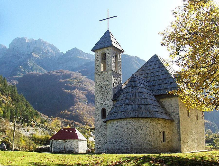
Photo credits: Theth Church Albania by peter_h, CC0, via Wikimedia Commons; Valbona, Albania by You may re-use this image under the terms of the license using the following reference: Image: Wikipedia / Tobias Klenze / CC-BY-SA 4.0. The license must be a link!, CC BY 3.0, via Wikimedia Commons; Sheu i keq, Reka e Allagës, Rugovë, Kosovë photo by Bresta, CC BY-SA 4.0, via Wikimedia Commons; Valbona Valley by Alexkom000, CC BY 4.0, via Wikimedia Commons; Mountains in Theth by Alexkom000, CC BY 4.0, via Wikimedia Commons; Valbona, Albania by You may re-use this image under the terms of the license using the following reference: Image: Wikipedia / Tobias Klenze / CC-BY-SA 4.0. The license must be a link!, CC BY 3.0, via Wikimedia Commons; Valbona, Albania by You may re-use this image under the terms of the license using the following reference: Image: Wikipedia / Tobias Klenze / CC-BY-SA 4.0. The license must be a link!, CC BY 3.0, via Wikimedia Commons; Plav Lake in Montenegro by Андрей Романенко, CC BY-SA 4.0, via Wikimedia Commons. Photos resized for the web. Figures are approximate and vary with the variant you choose.


