Getting there
- Flights to Poprad (TAT) 15 km from the start
- Flights to Balice (KRK) 110 km from the start
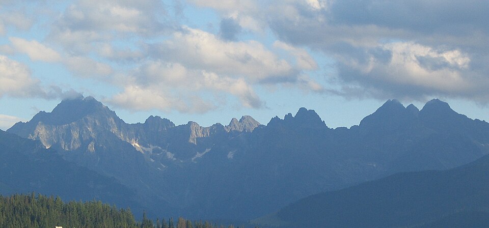
A classic multi-day path along the southern slopes of the High Tatras, linking mountain lakes and chalets.
Watch out: Many high trails in the Tatras are closed from November to mid-June.
Planning it for later? Save to Pinterest
It's a classic traverse of the High Tatras, Europe's smallest alpine range, with lakes and mountain chalets every day.
Some of these are affiliate links: if you book through them we may earn a small commission, at no extra cost to you. We only list services that fit this trek.
Phone plans from the EU and EEA roam here at home prices. Coming from the US, UK or elsewhere? A Europe data eSIM is usually far cheaper than roaming.
Expect long stretches with no signal on the trail. Download offline maps and our GPX before you start.
Most travel insurance includes hiking at this height. Check that hiking is listed and that medical evacuation is covered.
Rescue is not the same as evacuation. Travel insurance usually pays to fly you to hospital, but not always for the search and rescue itself. Read the policy's "search and rescue" section.
True Traveller sells only to residents of the UK and Europe. Always check the altitude limit and your country of residence in the policy wording. Our trekking insurance guide explains what to look for.
Camping is not allowed in the Tatra National Park. Use the mountain chalets along the route.
Rules change and differ between parks. Check with the local park or tourist office before you pitch a tent.
Measured by us along the OpenStreetMap trail with open elevation data (about 30 m resolution). Expect real figures a few percent higher: maps smooth out small zigzags and bumps, and the highest summits read slightly low.
Map layers load on the live site. Use the overview below meanwhile.
Trail from OpenStreetMap (50.2 km) Start / finish Stop on the way Nearest city
Switch between Topo, Satellite and Street layers with the layer button, and turn on the marked hiking trails overlay. The trail line is the OpenStreetMap hiking route and may differ from the variant you choose. Always carry a proper hiking map on the trail.
Stops: Štrbské Pleso → Popradské pleso → Hrebienok → Skalnaté pleso → Tatranská Lomnica
Best time: Mid-June to October
June to early July
Snow patches linger on north-facing slopes and high passes. Huts are just opening, meadows are full of flowers and paths are quieter.
Bring
Mid-July to August
Most reliable weather, but also the busiest huts and frequent afternoon thunderstorms. Hot in the valleys.
Bring
September
Clear, stable days and fewer people, but shorter daylight, cold nights and some huts closing mid to late September.
Bring
High trails close for part of the year to protect wildlife and for safety. Check the opening dates before you plan.
Thunderstorms often build after midday in summer. Start early, cross passes and summits before noon, and never shelter under lone trees or on ridges.
8 photos taken on and around the route by Wikimedia Commons photographers. Tap one to see it bigger.
Last updated 29 October 2026. Spotted something out of date? Tell us.
Photo credits: Tatry Panorama01xxx by the author named on its Commons page, CC BY-SA 3.0, via Wikimedia Commons; Strbske pleso from Krivan by Krivan, Public domain, via Wikimedia Commons; Mengusovská dolina, Vysoké Tatry by Michal Klajban, CC BY-SA 3.0, via Wikimedia Commons; Red fox (Vulpes vulpes crucigera) Skalnate Pleso by Charles J. Sharp, CC BY-SA 4.0, via Wikimedia Commons; Jastrabia veža from dolina Zeleného plesa by Marcin Białek, CC BY-SA 4.0, via Wikimedia Commons; Štrbské pleso, Štrba, Tatry by Fry72, CC BY-SA 4.0, via Wikimedia Commons; Waterfall - panoramio by BirdsEyeLV, CC BY-SA 3.0, via Wikimedia Commons; Batizovská dolina, Vysoké Tatry by Michal Klajban, CC BY-SA 3.0, via Wikimedia Commons. Photos resized for the web. Figures are approximate and vary with the variant you choose.


