Getting there
- Flights to Las Vegas (LAS) 285 km from the start
- Flights to Los Angeles (LAX) 295 km from the start
Treks / USA (California)
USA (California) · Nearest city: Los Angeles (also Las Vegas)
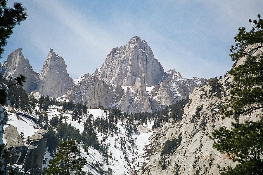
The highest summit in the contiguous United States, climbed on a long, well-built trail from Whitney Portal.
Watch out: Permits are allocated by lottery. Altitude sickness is common above Trail Camp.
It's the highest peak in the contiguous United States, on a trail that needs no climbing skills.
Some of these are affiliate links: if you book through them we may earn a small commission, at no extra cost to you. We only list services that fit this trek.
Roaming in USA is expensive on most phone plans. A data eSIM bought before you fly gets you online as soon as you land.
Expect long stretches with no signal on the trail. Download offline maps and our GPX before you start.
This trek reaches 4,421 m, and many policies stop covering hiking at 2,000 to 3,000 m unless you add an activity upgrade. World Nomads needs its Level 3 activities above 2,000 m, Heymondo its Adventure add-on above 3,000 m, and SafetyWing's Nomad Insurance covers trekking up to 4,500 m.
Rescue is not the same as evacuation. Travel insurance usually pays to fly you to hospital, but not always for the search and rescue itself. Read the policy's "search and rescue" section.
True Traveller sells only to UK and EEA residents. Always check the altitude limit and your country of residence in the policy wording. Our trekking insurance guide explains what to look for.
In national parks, overnight stays need a wilderness permit and camping is often limited to designated sites. On most national forest and BLM land, dispersed camping is allowed.
Rules change and differ between parks. Check with the local park or tourist office before you pitch a tent.
Map layers load on the live site. Use the overview below meanwhile.
Trail from OpenStreetMap (17.0 km) Start / finish Stop on the way Nearest city
Switch between Topo, Satellite and Street layers with the layer button, and turn on the marked hiking trails overlay. The trail line is the OpenStreetMap hiking route and may differ from the variant you choose. Always carry a proper hiking map on the trail.
Stops: Whitney Portal → Mount Whitney
Best time: July to September
June to early July
Snow on high passes, high creek crossings and roaring waterfalls. Mosquitoes emerge.
Bring
Mid-July to August
Stable, dry weather with afternoon thunderstorms over the high peaks. Permits are hardest to get.
Bring
September to early October
Clear, quiet and cold at night, with waterfalls reduced and the first snow possible.
Bring
Above about 3,000 m the air holds less oxygen. Walk slowly, drink plenty, don't rush acclimatisation days, and go down if you get a bad headache, nausea or confusion.
Expect 7–10 hour days. Start early, eat little and often, and know your turnaround time.
Thunderstorms often build after midday in summer. Start early, cross passes and summits before noon, and never shelter under lone trees or on ridges.
7 photos taken on and around the route by Wikimedia Commons photographers. Tap one to see it bigger.
Photo credits: Mount Whitney by Geographer (talk · contribs), CC BY 1.0, via Wikimedia Commons; Whitney Portal Road by MostlyDeserts, CC BY-SA 3.0, via Wikimedia Commons; Sunrise over mirror lake mt. whitney wilderness by Ben Kucinski, CC BY 2.0, via Wikimedia Commons; Good Morning from Mount Whitney by Jeremy Bishop tidesinourveins, CC0, via Wikimedia Commons; Mount Whitney, Touching the Clouds - Flickr - kla by Ron Reiring from Inland Empire of Southern California, USA, CC BY-SA 2.0, via Wikimedia Commons; Mount Whitney, east face, from Trail Camp, Sept. , - panoramio by Mark and Jan Rice, CC BY-SA 3.0, via Wikimedia Commons; Alabama Hills National Scenic Area by Matthew Dillon from Hollywood, CA, USA, CC BY 2.0, via Wikimedia Commons. Photos resized for the web. Figures are approximate and vary with the variant you choose.


.jpg)


.jpg)